Running News Daily
Running News Daily is edited by Bob Anderson. Send your news items to bob@mybestruns.com Advertising opportunities available. Train the Kenyan Way at KATA Kenya and Portugal owned and operated by Bob Anderson. Be sure to catch our movie A Long Run the movie KATA Running Camps and KATA Potato Farms - 31 now open in Kenya! https://kata.ke/
Index to Daily Posts · Sign Up For Updates · Run The World Feed
Timothy Olson Is Attempting a FKT on the PCT-The record he needs to break? 52 days
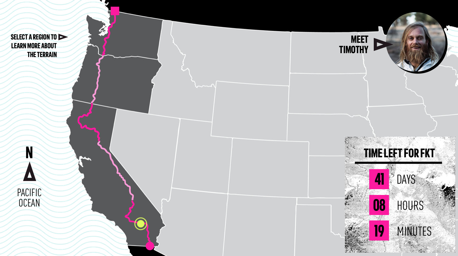
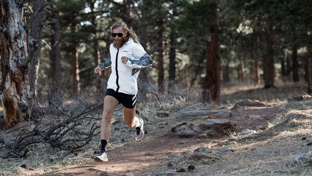
Ultrarunner and Adidas Terrex athlete Timothy Olson will attempt to set a fastest known time (FKT) on the 2,650-mile Pacific Crest Trail, starting at the California-Mexico border and finishing at Washington-Canada border. His goal? Break the current FKT of 52 days and change.
Timothy is a two-time winner and former record holder of the Western States 100-Mile Endurance Run. But he has a special connection to the Pacific Crest Trail, sections of which he’d run from his house in Ashland, Oregon, where he began his ultrarunning career a decade ago. Timothy has been training to set a FKT on the PCT for two years (last year’s attempt having been postponed by the COVID-19 pandemic). A self-professed “lover of life and explorer of nature,” Timothy’s goal on the attempt is to “live consciously” as he runs through the mountains. “I’m not trying to conquer nature,” he says. “I’m trying to move through and appreciate it.” Timothy wants his effort to be a celebration of our post-pandemic return to life. “I see this as a time for us all to reemerge from our cocoons,” he says. “I want to set a marker for what is possible.” Here's what he's up against—and how we plans to tackle it section by section.

Region 1: Southern California
Campo to Walker Pass: Miles 0-652
The southern terminus of the PCT is near the aptly named California town of Campo. A shoulder-high monument a few yards from the wall marking the Mexican border is the official starting point. From there, the trail forges north through the Sonoran Desert, through the Laguna Mountains and into the Mojave. Daytime temps here can spike to the hundreds in June, so Timothy plans on predawn starts. And because there can be up to 30 miles of trail between water sources, he will rely on midday water resupplies from his team at road crossings and trailheads.
Region 2: Central California
Walker Pass to Donner Pass: Miles 652-1,157
From Walker Pass, near the town of Kernville, the trail dips to the South Fork of the Kern River, the geographic start of the Sierra Nevada. Arguably the PCT’s most difficult section, the trail through the High Sierra spends considerable time above 10,000 feet, includes eight passes over 11,000 feet, and peaks at 13,153-foot Forester Pass, the PCT’s high point. Timothy calibrated his early-June start time to reach the High Sierra when most of the snow should be melted, so he won’t have to lug heavy gear like crampons and ice axes. The crux of his effort will be the remote section from Sequoia National Park through Yosemite National Park, where the PCT merges with the famously majestic John Muir Trail for 160 miles. Timothy likely won’t see his resupply team for several days in this section.
Region 3: Northern California
Donner Pass to Oregon Border: Miles 1,157-1,689
This Northern California section begins where Interstate 80 crosses Donner Pass and continues through the High Sierra, but then gives way to the drier volcanic peaks and plains of the southern Cascades. From there to the Oregon border, the skyline is dominated by the Mount Shasta stratovolcano. Three to four weeks into the six-week effort, Timothy will need to listen to his body to stave off overuse injuries; he may have to sleep an extra hour or two or shorten his days to let his feet, knees, or shins heal. But with his experience and abilities, says coach Koop, “he can be three days off the record in this section and make it up in a single day.”
Region 4: Oregon
California Border to Washington Border: Miles 1,689-2,144
The easiest section of the trail, the PCT through Oregon contains fewer significant elevation changes, though the route is no less stunning, winding through old-growth forests, skirting alpine lakes, and connecting snowcapped volcanoes—including Mount Washington, Mount Jefferson, and the iconic Mount Hood—that dominate the skyline. But while the run should be easier physically, Timothy will likely be getting trail weary by this point. That’s where meeting up with his family at trailheads and road crossings will be a boost. “A hug from [my son] Kai and I’ll be energized to run all day,” he says.
Region 5: Washington
Washington Border to Canadian Border: Miles 2,144-2,650
Beginning at the trail’s lowest elevation, the Bridge of the Gods (180 feet) over the Columbia River, the Washington section rises past the talismanic peaks of mounts Adams and Rainier and then northward into the rugged and remote north Cascades, probably the PCT’s second most difficult section. In addition to presenting extreme elevation gains and losses and intense, dangerous river crossings, the north Cascades can be the PCT’s wettest section, with frequent summer storms that should test Timothy’s resolve and gear. “I’ll go several consecutive 60- and 50-mile days without seeing my crew—and may arrive at the border alone if the access from Canada is still closed.”
by Outside On Line
Login to leave a comment


